
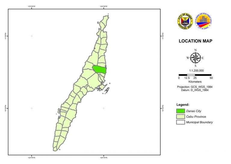
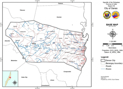
Danao city, a third class component city at the northern edge of the urban aggrupation that is called metropolitan cebu, has an area of 18, 019 has. That takes the form of an irregularly shaped rectangle sloping from west to east. It is actually the second largest of the 13 territorial units of metro cebu. The city has 42 barangays.
A. LANDFORMS
The lay of the land of Danao City follows the general topography of Cebu Island which is called an anticlinal fold, meaning it is an island folded by opposing tectonic forces and is characterized by a long ridge in middle from where the land slopes down to the sea.
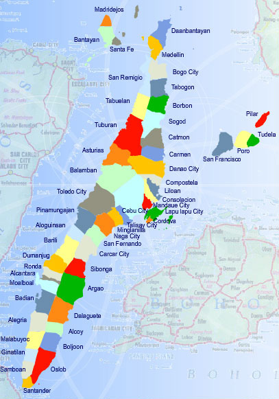
Danao City lies in the northern half of Cebu Province and appears as an elongated roughly rectangular area on the eastern side of the island ridge. It starts from the mountainous ridge and slopes down eastward to Camotes Sea. City may be said to have plains along the eastern coast, hills toward the west, and mountains.
Further west which are part of the island ridge system. There is a small part of the city west of the highlands that have an elevated plain area surrounded by hills. Like the eastern coastal plain, this flat part of City would be suitable for tourism-related land uses.
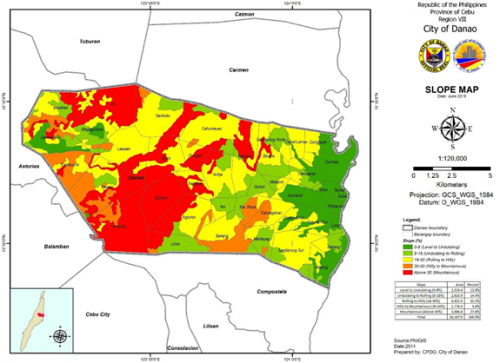
B. SLOPE
The level to undulating (0-18% slope) lands in Danao City is located along the eastern coast. Going west towards the uplands are pockets of undulating to rolling (8-18% slope) terrain occupying 2,572 has. And which are still suitable for urban and agricultural use. Spread all
over the city are the rolling to hilly (18-30% slope) areas occupying 6,461 has. This slope category occupies the biggest area in the city.
The hilly to mountainous (30-50% slope) terrain is located in the middle southern part and in the western end of the study area, although this slope category occupies the least area of 1,784 has. The lands with a slope range of 18 to 50% slope are suitable for regulated forestry, grazing, commercial, tree plantation, tourism and mining. By law, they cannot be alienated and disposed and can only be leased for 25 yeas, and renewed for another 25 years. The mountainous (above 50% slope) lands totaling 5,105 has. Are found in the middle and northwestern parts of the city.
The 0 to 18% slopes, make up only 26% of the city’s total area. However, there is more room for controlled grazing, tourism, commercial, tree plantation, production forest and mining as the suitable slopes (18-50% slope) make up 45% of the city area. For these steeply sloping and, therefore, erodible lands to be suitable at least for agriculture, well-maintained innovative methods such as terracing and sloping agricultural land technology (SALT) may be resorted to.
- Elevation
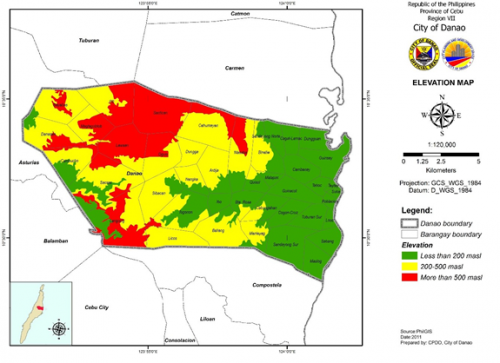
All lands in the city are below 1000 meters in elevation and, based on the National Integrated Protected Areas System (NIPAS) Law (R.A. 7586), these are all considered as developable. The most developable for urban and agricultural use are the lands ranging from 0 to 200 meters above sea level as these are presumed to have gradual slopes that would facilitate movement of goods and people.
These are located on the eastern side of the study area and have a total area of 6,802 has. (38%). Spread over the western three fourths of the city are lands with elevations ranging from 200 to 500 meters above sea level and occupying 3,827 has. (21%)
A lot of these lands, however, are steeply sloping and can be recommended only for controlled forestry, commercial tree plantation, grazing and tourism. Elevations ranging from 500 to 1000 meters are located in the western part of the city and constitute 7,390 has. (41%).
As temperatures in these areas are rather cool, they may be used for growing temperate crops, with the proviso, however, that innovative farming techniques should be employed since lands in these elevations have steep and therefore erodible slopes.